Liste der Landschaftsschutzgebiete im Kreis Recklinghausen
Die Liste der Landschaftsschutzgebiete im Kreis Recklinghausen enthält die Landschaftsschutzgebiete des Kreises Recklinghausen in Nordrhein-Westfalen.
Liste
| Bild | Kennung | Name | Fläche [ha] | WDPA-ID | Koordinaten | seit |
|---|---|---|---|---|---|---|
| LSG-4108-0002 | LSG-Heubachniederung, Weisses Venn, Lavesumer Bruch | 975,63 | Position51.80637.17169 | 1988 | ||
| LSG-4108-0003 | LSG-Huegelland Hohe Mark | 4265,31 | Position51.76397.11977 | 1988 | ||
| LSG-4109-0003 | LSG-Baggerseen Sythen, Hausduelmen-Schmaloer Heide | 709,18 | Position51.79757.21915 | 1988 | ||
| LSG-4207-0002 | LSG-Rhader Hoefe | 551,83 | 555553612 | Position51.76466.92912 | 1988 | |
| LSG-4207-0003 | LSG-Wessendorfer Elven, Wessendorfer Heiden | 2353,10 | 555553613 | Position51.77326.99313 | 1988 | |
| LSG-4207-0004 | LSG-Barkeler und Emmelkaemper Mark | 1171,65 | 555553614 | Position51.70826.93885 | 1988 | |
| LSG-4207-0005 | LSG-Lembecker Hagen | 1579,11 | 555553615 | Position51.73656.99042 | 1988 | |
| LSG-4207-0006 | LSG-Gerlicher Heide | 627,34 | 555553616 | Position51.69956.98104 | 1988 | |
| LSG-4208-0001 | LSG-Gebiet am Wesel-Datteln-Kanal um Hamm und Bossendorf | 231,38 | 555553617 | Position51.71997.17856 | 1990 | |
| LSG-4208-0002 | LSG-Gebiet des noerdlichen Forstes Haltern oestlich und westlich der B 51 | 821,41 | 555553618 | Position51.70967.19123 | 1990 | |
| LSG-4208-0003 | LSG-Gebiet nordwestlich und suedoestlich der Marler Straße bei Sickingmuehle | 247,55 | 555553619 | Position51.70237.13668 | 1990 | |
| LSG-4208-0004 | LSG-Gebiet oestlich und westlich der Huelsbergstrasse in Marl | 122,71 | 555553620 | Position51.69297.14252 | 1990 | |
| LSG-4208-0005 | LSG-Westlicher Rand der Hohen Mark | 558,84 | 555553621 | Position51.76277.04512 | 1988 | |
| LSG-4208-0006 | LSG-Gebiet des suedlichen Forstes Haltern oestlich und westlich der B 51 | 727,64 | 555553622 | Position51.69327.16893 | 1990 | |
| LSG-4208-0007 | LSG-Dimke | 158,74 | 555553623 | Position51.72697.05172 | 1988 | |
| LSG-4208-0008 | LSG-Grosse Heide, Wulfener Heide, Lange Heide | 1422,97 | 555553624 | Position51.69947.03653 | 1988 | |
| LSG-4208-0009 | LSG-Strocker Flachwellen und Eppendorfer Flachwellen | 1266,70 | Position51.73397.09652 | 1988 | ||
| LSG-4208-0010 | LSG-Lippramsdorfer Flachwellen und Niederungen | 722,01 | 555553626 | Position51.71317.09191 | 1988 | |
| LSG-4208-0011 | LSG-Haltern Lippetal und Dattelner Lippetal | 810,21 | 555691042 | Position51.69997.2872 | 1988 | |
| LSG-4208-0012 | LSG-Sickingmuehlenbach | 54,36 | 555553628 | Position51.69577.11549 | 1988 | |
| LSG-4209-0001 | LSG-Gebiet suedlich von Flaesheim | 529,10 | 555553629 | Position51.70547.22659 | 1990 | |
| LSG-4209-0002 | LSG-Gebiet am Wesel-Datteln-Kanal westlich und oestlich von Flaesheim | 102,26 | 555553630 | Position51.71647.23888 | 1990 | |
| LSG-4209-0003 | LSG-Gebiet der Flaesheimer Bucht | 119,36 | 555553631 | Position51.70887.25335 | 1990 | |
| LSG-4209-0004 | LSG-Gebiet mit Schrammberg und Levisch Berge | 298,51 | 555553632 | Position51.7057.26703 | 1990 | |
| LSG-4209-0006 | LSG-Gebiet westlich und östlich des Gernebaches bestehend aus zwei voneinander getrennten Teilen | 704,80 | 555553634 | Position51.69167.26326 | 1990 | |
| LSG-4209-0007 | LSG-Gebiet des unteren Gernebachtales | 53,70 | 555553635 | Position51.70127.28131 | 1990 | |
| LSG-4209-0008 | LSG-Uphuser und Sythener Mark | 879,28 | 555553636 | Position51.77337.19558 | 1988 | |
| LSG-4209-0009 | LSG-Der Linnert | 605,26 | Position51.77957.24705 | 1988 | ||
| LSG-4209-0010 | LSG-Stadtforst Haltern | 666,84 | Position51.75897.2497 | 1988 | ||
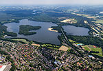 | LSG-4209-0011 | LSG-Stausee Haltern | 995,22 | 555553640 | Position51.74447.25441 | 1988 |
| LSG-4209-0012 | LSG-Westruper Heide, Struebings Heide | 770,51 | 555553641 | Position51.73197.26891 | 1988 | |
| LSG-4307-0001 | LSG-Breiker Hoefe | 253,86 | 555553815 | Position51.60986.98678 | 1988 | |
| LSG-4307-0002 | LSG-Emmelkaemper Brauck | 310,56 | 555691043 | Position51.67586.92445 | 1988 | |
| LSG-4307-0003 | LSG-Ruetterberg, Oestrich | 360,34 | 555553817 | Position51.6546.914 | 1988 | |
| LSG-4307-0005 | LSG-Hardt, Schwickingsfeld, Lohmannskamp | 310,54 | 555553819 | Position51.64366.9482 | 1988 | |
| LSG-4307-0008 | LSG-Schoelzbach, Ulfkotter Heide | 405,92 | 555553822 | Position51.63376.98527 | 1988 | |
| LSG-4307-0009 | LSG-Rapphofs Muehlenbach, Erdbach, Barloer Busch | 924,29 | 555553823 | Position51.64577.01193 | 1988 | |
| LSG-4308-0001 | LSG-Gebiet an der A43 noerdlich Brinkfortsheide | 75,52 | 555553827 | Position51.68447.14734 | 1990 | |
| LSG-4308-0002 | LSG-Gebiet der ehemaligen Brinkfortsheide(Haldenflaeche) | 86,99 | 555553828 | Position51.67717.14976 | 1990 | |
| LSG-4308-0003 | LSG-Westerholt - Herten | 365,48 | 555553829 | Position51.59377.10515 | 1988 | |
| LSG-4308-0004 | LSG-Herten-Recklinghausen | 391,09 | 555553830 | Position51.58967.17488 | 2008 | |
| LSG-4308-0005 | LSG-Frentroper Mark | 735,98 | 555553831 | Position51.66967.05499 | 1988 | |
| LSG-4308-0006 | LSG-Rennbach | 1061,78 | 555553832 | Position51.63557.06418 | 1988 | |
| LSG-4308-0007 | LSG-Herten <temporaer> | 19,92 | 555553833 | Position51.61887.12385 | 2012 | |
| LSG-4308-0008 | LSG-Bertlich | 294,03 | 555553834 | Position51.61827.09103 | 2012 | |
| LSG-4308-0009 | LSG-Loemuehlenbach | 968,08 | 555553835 | Position51.63687.13158 | 2012 | |
| LSG-4308-0010 | LSG-Westlicher Hoehenruecken | 457,50 | 555553836 | Position51.62487.16694 | 2012 | |
| LSG-4308-0011 | LSG-Silvertbach | 635,00 | 555553837 | Position51.64727.18834 | 2012 | |
| LSG-4308-0012 | LSG-Marl <temporaer> | 59,60 | 555553838 | Position51.64727.12063 | 2012 | |
| LSG-4309-0001 | LSG-Gebiet an der Ahsener Allee, bestehend aus 3 voneinander getrennten Teilen oestlich, suedlichen und westlich des NSG "Gernebach" | 16,51 | 555589449 | Position51.69197.25953 | 1990 | |
| LSG-4309-0002 | LSG-Gebiet suedlich der Krankenanstalt oestlich und westlich der B 51 | 465,18 | 555553844 | Position51.68347.19877 | 1990 | |
| LSG-4309-0003 | LSG-Gebiet noerdlich von Oer-Erkenschwick | 689,38 | 555553845 | Position51.67277.24987 | 1990 | |
| LSG-4309-0004 | LSG-Gebiet des oestlichen Haardhuegel- und Haardvorlandes | 374,32 | 555553846 | Position51.67587.28255 | 1990 | |
| LSG-4309-0005 | LSG-Gebiet noerdlich Sinsen | 210,60 | 555553847 | Position51.67467.19122 | 1990 | |
| LSG-4309-0006 | LSG-Panhuetter Weg <temporaer> | 27,68 | 555553848 | Position51.60117.22804 | 2008 | |
| LSG-4309-0007 | LSG-Gebiet noerdlich und suedlich der L 798 in Oer-Erkenschwick und Marl | 731,03 | 555553849 | Position51.66447.21732 | 1990 | |
| LSG-4309-0008 | LSG-Gebiet bei Oer-Erkenschwick, Lohaeuser Berg und Rapen | 112,24 | 555553850 | Position51.65497.26938 | 1990 | |
| LSG-4309-0009 | LSG-Gebiet im Bereich Dillenburg, Oer-Erkenschwick, bestehend aus zwei voneinander getrennten Teilen | 44,76 | 555553851 | Position51.65587.2841 | 1990 | |
| LSG-4309-0010 | LSG-Gebiet im Bereich Dillenburg, Oer-Erkenschwick | 54,33 | 555553852 | Position51.65417.29358 | 1990 | |
| LSG-4309-0011 | LSG-Gebiet oestlich des Gewerbe- und Industriekomplexes Oer-Erkenschwick - Rapen | 41,41 | 555553853 | Position51.64797.2941 | 1990 | |
| LSG-4309-0012 | LSG-Dattelner Haardvorland | 1589,14 | 555553854 | Position51.66467.31254 | 1988 | |
| LSG-4309-0013 | LSG-Losheide, Deinebach, Oberwieser Bach | 1173,47 | 555553855 | Position51.6357.36372 | 1988 | |
| LSG-4309-0014 | LSG-Becklem | 246,88 | 555553856 | Position51.61857.30329 | 1988 | |
| LSG-4309-0015 | LSG-Oberwiese, Leveringhausen, Herdicksbach | 972,02 | 555553857 | Position51.60417.3569 | 1988 | |
| LSG-4309-0016 | LSG-Oestlicher Hoehenruecken | 601,55 | 555553858 | Position51.63497.21911 | 2012 | |
| LSG-4309-0017 | LSG-Essel/Westerbach | 730,95 | 555553859 | Position51.62487.26701 | 2012 | |
| LSG-4309-0018 | LSG-Becklem/Suderwich | 160,37 | 555553860 | Position51.60917.28874 | 2012 | |
| LSG-4309-0019 | LSG-Recklinghausen <temporaer> | 44,05 | 555553861 | Position51.62357.19248 | 2012 | |
| LSG-4309-0020 | LSG-Lohfeld | 151,51 | 555553862 | Position51.61127.23422 | 2012 | |
| LSG-4309-0021 | LSG-Oer-Erkenschwick <temporaer> | 16,07 | 555553863 | Position51.64127.26447 | 2012 | |
| LSG-4310-0001 | LSG-Waltroper Lippetal/Dortmunder Rieselfelder/Schwarzbach | 1538,01 | 555553864 | Position51.64777.41334 | 1988 | |
| LSG-4310-0002 | LSG-Brockenscheidt, Elmenhorst | 753,11 | 555553865 | Position51.60677.41786 | 1988 | |
| LSG-4407-0004 | LSG-Nordoestlicher Ortsrand von Zweckel <temporaer> | 1,22 | 555554066 | Position51.59846.99005 | 2001 | |
| LSG-4407-0006 | LSG-Westlich Hof Klaas <temporaer> | 2,12 | 555554068 | Position51.5866.96888 | 2001 | |
| LSG-4407-0010 | LSG-Haarbach <temporaer> | 20,70 | 555554072 | Position51.57036.96237 | 1988 | |
| LSG-4407-0012 | LSG-Die Lune | 77,82 | 555554074 | Position51.58646.99273 | 1988 | |
| LSG-4407-0013 | LSG-Wittringer Wald | 157,29 | 555554075 | Position51.56116.97567 | 1988 | |
| LSG-4407-0014 | LSG-Ellinghorst - Koesheide | 139,21 | 555554076 | Position51.55136.96837 | 1988 | |
| LSG-4407-0015 | LSG-Brabecker Muehlenbach | 57,42 | 555554077 | Position51.59316.95582 | 2001 | |
| LSG-4407-0016 | LSG-Gruenzug Schultendorf | 79,07 | 555554078 | Position51.58616.96876 | 2001 | |
| LSG-4407-0017 | LSG-Bohmertstrasse - Steinstrasse | 6,84 | 555554079 | Position51.56576.99058 | 2001 | |
| LSG-4407-0018 | LSG-Berliner Straße / Uchtmannstrasse <temporaer> | 9,40 | 555554080 | Position51.58936.95785 | 2001 | |
| LSG-4407-0019 | LSG-Winkelstrasse / Voßstraße | 1,44 | 555554081 | Position51.59166.99555 | 2001 | |
| LSG-4407-0020 | LSG-Hegestrasse <temporaer> | 11,05 | 555554082 | Position51.56766.92697 | 2001 | |
| LSG-4407-0021 | LSG-Brauck | 155,69 | 555554083 | Position51.54576.99379 | 1988 | |
| LSG-4408-0001 | LSG-Haldenlandschaft Hoppenbruch | 84,91 | 555554092 | Position51.56027.15233 | 1988 | |
| LSG-4408-0002 | LSG-Gruenzug Ost | 101,80 | 555554093 | Position51.57357.01259 | 1988 | |
| LSG-4408-0006 | LSG-Wielandstrasse <temporaer> | 9,84 | 555554094 | Position51.56767.01148 | 2001 | |
 | LSG-4409-0001 | LSG-Castroper Holz - Bladenhorst | 360,57 | 555554114 | Position51.56577.28323 | 1988 |
| LSG-4409-0002 | LSG-Habinghorst | 25,39 | 555554115 | Position51.58517.2995 | 1988 | |
| LSG-4409-0003 | LSG-Behringhausen | 87,79 | 555554116 | Position51.55127.28654 | 1988 | |
| LSG-4409-0004 | LSG-Westlicher Castroper Hoehenruecken | 135,77 | 555554117 | Position51.53077.30896 | 1988 | |
| LSG-4409-0005 | LSG-Schweriner Hoehenruecken, Landwehrbachtal-Schellenberg, Cottenburg | 89,29 | 555554118 | Position51.53967.32356 | 1988 | |
| LSG-4409-0006 | LSG-Ortloh II <temporaer> | 15,77 | 555554119 | Position51.59897.25746 | 2008 | |
| LSG-4409-0007 | LSG-Noerdliches Waldgebiet | 23,91 | 555554120 | Position51.57937.32485 | 1999 | |
| LSG-4409-0008 | LSG-Oestliches Roellinghausen <temporaer> | 17,42 | 555554121 | Position51.59147.25132 | 2008 | |
| LSG-4409-0009 | LSG-Poeppinghausen <temporaer> | 1,72 | 555554122 | Position51.57767.26426 | 2008 | |
 | LSG-4409-0010 | LSG-Langeloh, Distelkamp | 36,59 | 555561063 | Position51.53977.29885 | 1999 |
 | LSG-4409-0011 | LSG-Poeppinghausen - Insel zwischen Emscher und Rhein-Herne-Kanal | 188,74 | 555554124 | Position51.57787.26983 | 2008 |
| LSG-4409-0012 | LSG-Recklinghausen - Suderwich | 262,28 | 555554125 | Position51.59227.25337 | 2008 | |
| LSG-4409-0013 | LSG-Stuckenbusch <temporaer> | 10,98 | 555554126 | Position51.59127.18191 | 2008 | |
| LSG-4409-0014 | LSG-Flautwiesen <temporaer> | 3,91 | 555561064 | Position51.57767.178 | 2001 | |
| LSG-4409-0015 | LSG-Kanalbereich Habinghorst <temporaer> | 7,28 | 555561065 | Position51.58497.29258 | 1999 | |
| LSG-4409-0016 | LSG-Freiraumbereich Stadtmittelpunkt <temporaer> | 38,71 | 555554129 | Position51.56497.31887 | 1999 | |
| LSG-4409-0017 | LSG-Waldflaeche am schwarzen Berg <temporaer> | 20,41 | 555554130 | Position51.57847.32132 | 1999 | |
| LSG-4409-0018 | LSG-Am Kraftwerk Kloeckner (temp.) | 9,60 | 555554131 | Position51.5817.3229 | 1999 | |
| LSG-4409-0019 | LSG-Oestlicher Castroper Hoehenruecken | 282,23 | 555554132 | Position51.53257.34331 | 1988 | |
| LSG-4409-0020 | LSG-Rieperberg | 146,86 | 555554133 | Position51.55597.334 | 1988 | |
| LSG-4409-0021 | LSG-Grutholz und Beerenbruch | 157,61 | 555554134 | Position51.57117.32426 | 1988 | |
| LSG-4409-0022 | LSG-Emscherniederung | 52,77 | 555554135 | Position51.58567.35968 | 1988 | |
| LSG-4409-0023 | LSG-Emscheraue | 271,49 | 555554136 | Position51.58577.26963 | 1988 | |
| LSG-4409-0024 | LSG-Brandheide | 172,72 | 555554137 | Position51.59427.27995 | 1988 | |
| LSG-4410-0001 | LSG-Westhofsches Feld, Dingerdal | 77,52 | 555554165 | Position51.55057.34532 | 1988 | |
| LSG-4410-0002 | LSG-Deininghauser Bachbereich | 151,47 | 555554166 | Position51.56527.34169 | 1988 |
Siehe auch
Weblinks
Commons: Landschaftsschutzgebiete im Kreis Recklinghausen – Sammlung von Bildern, Videos und Audiodateien
- Datenquelle, Datei CDDA_v12_csv.zip, Stand Oktober 2014.
- Landschaftspläne im Kreis Recklinghausen. Kreis Recklinghausen; abgerufen am 7. März 2021
- Karte mit allen Koordinaten:
- OSM
- WikiMap

Städteregion Aachen | Bielefeld | Bochum | Bonn | Borken | Bottrop | Coesfeld | Dortmund | Duisburg | Düren | Düsseldorf | Ennepe-Ruhr-Kreis | Essen | Euskirchen | Gelsenkirchen | Gütersloh | Hagen | Hamm | Heinsberg | Herford | Herne | Hochsauerlandkreis | Höxter | Kleve | Köln | Krefeld | Leverkusen | Lippe | Märkischer Kreis | Mettmann | Minden-Lübbecke | Mönchengladbach | Mülheim an der Ruhr | Münster | Oberbergischer Kreis | Oberhausen | Olpe | Paderborn | Recklinghausen | Remscheid | Rhein-Erft-Kreis | Rheinisch-Bergischer Kreis | Rhein-Kreis Neuss | Rhein-Sieg-Kreis | Siegen-Wittgenstein | Soest | Solingen | Steinfurt | Unna | Viersen | Warendorf | Wesel | Wuppertal


