Colorado Springs metropolitan area
Metropolitan area in Colorado, United States
Metropolitan Statistical Area in Colorado, United States
Colorado Springs, CO Metropolitan Statistical Area | ||
|---|---|---|
Metropolitan Statistical Area | ||
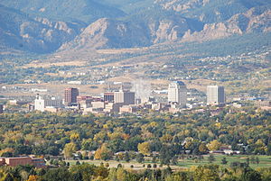 Colorado Springs skyline with the Front Range in the background | ||
 Colorado Springs, CO MSA
| ||
| Country |  United States United States | |
| State |  Colorado Colorado | |
| Largest city | - Colorado Springs | |
| Time zone | UTC−7 (MST) | |
| • Summer (DST) | UTC−6 (MDT) | |
The Colorado Springs, CO, Metropolitan Statistical Area is a United States Office of Management and Budget defined Metropolitan Statistical Area (MSA) located in the Colorado Springs region of the State of Colorado. The 2020 United States census counted a population of 755,105,[1] an increase of 17.0% since the 2010 United States Census. The Colorado Springs MSA is the 79th-most populous MSA in the United States.[2] The Colorado Springs MSA encompasses El Paso County and Teller County, Colorado. Approximately 88.40% percent of the MSA's population live in cities or CDPs. The Colorado Springs Metropolitan Statistical Area is the second-most populous component of the Front Range Urban Corridor.
| County | 2020 census | 2010 census | Change |
|---|---|---|---|
| El Paso County | 730,395 | 622,263 | +17.38% |
| Teller County | 24,710 | 23,350 | +5.82% |
| Total | 755,105 | 645,613 | +16.96% |
Metropolitan area cities and towns
| Census | Pop. | Note | %± |
|---|---|---|---|
| 1960 | 146,237 | — | |
| 1970 | 239,288 | 63.6% | |
| 1980 | 317,458 | 32.7% | |
| 1990 | 409,482 | 29.0% | |
| 2000 | 537,484 | 31.3% | |
| 2010 | 645,613 | 20.1% | |
| 2020 | 755,105 | 17.0% | |
| sources:[4] | |||
| Place | Name | 2020 population | Notes |
|---|---|---|---|
| 1 | City of Colorado Springs | 478,961 | |
| 2 | Security-Widefield | 38,639 | CDP |
| 3 | City of Fountain | 29,802 | |
| 4 | Cimarron Hills | 19,311 | CDP |
| 5 | Fort Carson | 17,693 | CDP |
| 6 | Black Forest | 15,097 | CDP |
| 12 | Town of Monument | 10,399 | |
| 7 | Woodmoor | 9,536 | CDP |
| 8 | City of Woodland Park | 7,920 | |
| 11 | Gleneagle | 6,649 | CDP |
| 10 | Air Force Academy | 6,608 | CDP |
| 9 | Stratmoor | 6,518 | CDP |
| 13 | City of Manitou Springs | 4,858 | |
| 14 | Town of Palmer Lake | 2,636 | |
| 15 | Cascade-Chipita Park | 1,628 | CDP |
| 17 | Ellicott | 1,248 | CDP |
| 16 | City of Cripple Creek | 1,155 | |
| 18 | Town of Calhan | 762 | |
| 19 | Town of Green Mountain Falls | 646 | |
| 20 | City of Victor | 379 | |
| 21 | Peyton | 214 | CDP |
| 22 | Midland | 182 | CDP |
| 23 | Divide | 143 | CDP |
| 25 | Florissant | 128 | CDP |
| 24 | Town of Ramah | 111 | |
| 26 | Rock Creek Park | 68 | CDP |
| 27 | Goldfield | 63 | CDP |
| TOTAL | 661,354 |
Unincorporated communities
See also
 Geography portal
 North America portal
 United States portal
 Colorado portal


- El Paso County, Colorado
- Teller County, Colorado
- List of statistical areas in Colorado
- List of United States combined statistical areas
- List of United States metropolitan statistical areas
- List of United States micropolitan statistical areas
- List of United States primary statistical areas
- Larger urban regions that contain the Colorado Springs Metropolitan Statistical Area:
- Census statistical areas adjacent to Colorado Springs Metropolitan Statistical Area:
References
- ^ Star, Indianapolis. "Colorado Springs, CO Metro Area Demographics and Housing 2020 Decennial Census". Indianapolis Star. Retrieved 2022-01-27.
- ^ "Table 1. Annual Estimates of the Population of Metropolitan and Micropolitan Statistical Areas: April 1, 2010 to July 1, 2012 (CBSA-EST2012-01)" (CSV). 2012 Population Estimates. United States Census Bureau, Population Division. 2012-03-23. Retrieved 2013-11-05.
- ^ "Annual Estimates of the Resident Population for Counties of Colorado: April 1, 2010 to July 1, 2011". 2011 Population Estimates. United States Census Bureau, Population Division. April 2012. Archived from the original (CSV) on November 14, 2012. Retrieved April 18, 2012.
- ^ census.gov – Idaho population by county, 1900–90 accessed 2009-05-03
- ^ "SAS Output". Archived from the original on 2012-07-11. Retrieved 2011-04-25.
- v
- t
- e

- Colorado Springs metropolitan area
- Buildings
- Companies
- Geography
- History
- Mining industry
- Organizations
- People from Colorado Springs
- Tallest buildings
- Tuberculosis treatment

- Broadmoor World Arena
- Colorado Springs City Auditorium
- Colorado Springs Fine Arts Center
- Colorado Springs Philharmonic
- Cultural Office of the Pikes Peak Region
- Flag
- Parks
- Pikes Peak Center for the Performing Arts
- Pioneers Museum
- Religious institutions
- Cheyenne Mountain
- Cheyenne Mountain Zoo
- Garden of the Gods
- Glen Eyrie
- Manitou Springs, Colorado
- Old Colorado City
- Parks
- Peterson Air and Space Museum
- Pikes Peak
- ProRodeo Hall of Fame
- Seven Falls
- United States Olympic Training Center
- Western Museum of Mining & Industry
- Will Rogers Shrine of the Sun
- World Figure Skating Hall of Fame
- Bustang
- Colorado Springs Airport
- Colorado Springs East Airport (private)
- Front Range Express (FREX)
- Mountain Metropolitan Transit
and historic places
- Banning Lewis Ranch
- Boulder Crescent Place Historic District
- Broadmoor
- Cragmor
- Ivywild
- Knob Hill
- Old Colorado City
- Old North End Historic District
- Pikeview (Pinecliff)
- Roswell
- Papeton (Venetian Village)
- St. Peter's Dome
- See also National Register of Historic Places in Colorado Springs, Colorado


