Concepción Province, Peru
Province in Junín, Peru

Coat of arms
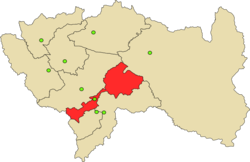
Location of Concepción in the Junín Region
(2019-2022)
Concepción Province is one of nine provinces in the Junín Region in central Peru. Its capital is Concepción.
Notable sites include "El convento de Santa Rosa de Ocopa", which contains a vast library and artefacts that were acquired from the first Spanish expeditions to the Peruvian Amazon rainforest.
Geography
The Huaytapallana mountain range traverses the province.
Some of the highest peaks of the province are:[1]
- Allpa Q'asa
- Anchhi
- Aywin
- Challwayuq
- Chichi Q'asa
- Ch'uspi
- Kawituyuq
- Kimaqucha
- Kimsa Uchku
- Kiswar
- Liwinayuq
- Llant'a Pallaku
- Lasu Pata
- Marayrasu
- Muratayuq
- Pachaqniyuq
- Pinkuylluyuq Punta
- Puma Kusma
- Putkaqucha
- Putkaqucha (Concepción)
- Puywan
- Quchayuq
- Qutu Qutu
- T'illu
- Uma Pukyu
- Utkhulasu
- Utkhu Warqu
- Wamanripayuq
- Warmi Sinqa
- Waytapallana
- Yanaqucha
Political division
The province is divided into seventeen districts (Spanish: distritos, singular: distrito), each of which is headed by a mayor (alcalde):
- Concepción
- Aco
- Andamarca
- Chambara
- Cochas
- Comas
- Heroínas Toledo
- Manzanares
- Mariscal Castilla
- Matahuasi
- Mito
- Nueve de Julio
- Orcotuna
- San José
- Santa Rosa de Ocopa
References
- ^ escale.minedu.gob.pe/ UGEL map of the Concepción Province (Junín Region)
External links
- Municipal website (in Spanish)

11°55′07″S 75°18′46″W / 11.918478°S 75.312889°W / -11.918478; -75.312889
 | This Junín Region geography article is a stub. You can help Wikipedia by expanding it. |
- v
- t
- e


