Gonabad County
County in Razavi Khorasan province, Iran
County in Razavi Khorasan, Iran
Gonabad County Persian: شهرستان گناباد | |
|---|---|
County | |
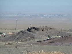 Castle of Yazdegerd III | |
 Location of Gonabad County in Razavi Khorasan Province (bottom, pink) | |
 Location of Razavi Khorasan Province in Iran | |
| Coordinates: 34°26′N 58°52′E / 34.433°N 58.867°E / 34.433; 58.867[1] | |
| Country | Iran |
| Province | Razavi Khorasan |
| Capital | Gonabad |
| Districts | Central, Kakhk |
| Area | |
| • Total | 5,789 km2 (2,235 sq mi) |
| Elevation | 1,105 m (3,625 ft) |
| Population (2016)[2] | |
| • Total | 88,753 |
| • Density | 15/km2 (40/sq mi) |
| Time zone | UTC+3:30 (IRST) |
Gonabad County (Persian: شهرستان گناباد) is in Razavi Khorasan Province, Iran. Its capital is the city of Gonabad.[3]
Demographics
Population
At the time of the 2006 National Census, the county's population was 106,158, in 30,357 households.[4] The following census in 2011 counted 80,783 people in 24,292 households,[5] by which time Bajestan District had been separated from the county in the establishment of Bajestan County.[6] At the 2016 census, Gonabad County's population was 88,753 in 27,607 households.[2]
Administrative divisions
Gonabad County's population history and administrative structure over three consecutive censuses are shown in the following table.
| Administrative Divisions | 2006[4] | 2011[5] | 2016[2] |
|---|---|---|---|
| Central District | 64,849 | 69,773 | 76,427 |
| Howmeh RD | 16,701 | 18,727 | 20,989 |
| Pas Kalut RD | 8,762 | 9,331 | 9,164 |
| Bidokht (city) | 4,823 | 5,348 | 5,501 |
| Gonabad (city) | 34,563 | 36,367 | 40,773 |
| Bajestan District[a] | 29,495 | ||
| Bajestan RD | 3,382 | ||
| Jazin RD | 5,294 | ||
| Yunesi RD | 6,334 | ||
| Bajestan (city) | 11,136 | ||
| Yunesi (city) | 3,349 | ||
| Kakhk District | 11,814 | 11,010 | 12,326 |
| Kakhk RD | 3,052 | 2,354 | 2,809 |
| Zibad RD | 4,747 | 4,243 | 4,892 |
| Kakhk (city) | 4,015 | 4,413 | 4,625 |
| Total | 106,158 | 80,783 | 88,753 |
| RD = Rural District | |||
Climate and geography
Gonabad is in a plate area on the north of the Brakoh mountain or Kūh-e Tīr Māhī[7]
Historical places
Gallery
-
 Zibad Castle
 -
 Zibad Mountain
 -
 Sassanian Castel
 -
 Ancient water clock used in a qanat of Gonabad 2500 years ago


See also
![]() Media related to Gonabad County at Wikimedia Commons
Media related to Gonabad County at Wikimedia Commons
Notes
- ^ Transferred to Bajestan County[6]
References
- ^ OpenStreetMap contributors (29 April 2023). "Gonabad County" (Map). OpenStreetMap. Retrieved 29 April 2023.
- ^ a b c "Census of the Islamic Republic of Iran, 1395 (2016)". AMAR (in Persian). The Statistical Center of Iran. p. 09. Archived from the original (Excel) on 2 April 2022. Retrieved 19 December 2022.
- ^ Habibi, Hassan (21 June 1369). "Approval of the organization and chain of citizenship of the elements and units of the divisions of Khorasan province, centered in Mashhad". Islamic Parliament Research Center (in Persian). Ministry of Interior, Defense Political Commission of the Government Board. Archived from the original on 17 November 2015. Retrieved 6 January 2024.
- ^ a b "Census of the Islamic Republic of Iran, 1385 (2006)". AMAR (in Persian). The Statistical Center of Iran. p. 09. Archived from the original (Excel) on 20 September 2011. Retrieved 25 September 2022.
- ^ a b "Census of the Islamic Republic of Iran, 1390 (2011)". Syracuse University (in Persian). The Statistical Center of Iran. p. 09. Archived from the original (Excel) on 20 January 2023. Retrieved 19 December 2022.
- ^ a b Davodi, Parviz. "Approval letter regarding reforms of country divisions in Razavi Khorasan province, Gonabad County". Islamic Parliament Research Center of the Islamic Republic of Iran (in Persian). Ministry of Interior, Political-Defense Commission of the Government Board. Archived from the original on 20 October 2020. Retrieved 8 November 2023.
- ^ Ajam, Mohammad. Geography and tribes and minorities in Khorasan, research published 1992, University of Imam Sadegh, Tehran
- v
- t
- e

- Abbasabad Complex
- Tomb of Abdolabad
- Aliabad Tower
- Amin al-tojar Caravansarai
- Atashgah Manmade-Cave
- Atashgah Castle
- Firuzabad area
- Firuzabad Tower
- Goharshad Mosque
- Haj Soltan Religious School
- Haji Jalal Mosque
- Haruniyeh Dome
- Imam Reza shrine
- Imamzadeh Hamzeh, Kashmar
- Imamzadeh Seyed Morteza
- Jameh Mosque of Kashmar
- Jameh Mosque of Marandiz
- Jameh Mosque of Nishapur
- Jameh Mosque of Sabzevar
- Karat Minaret
- Khosrogerd Minaret
- Kondor Ab anbars
- Kūh-e Tīr Māhī
- Mausoleum of Attar of Nishapur
- Mausoleum of Omar Khayyám
- Khalilabad Hot Spring
- Pamenar Mosque, Sabzevar
- Qanats of Ghasabeh
- Ribat of Kabudan
- Ribat of Sharaf
- Rig castle
- Shahi Dam
- Sheikh Ahmad-e Jami mausoleum complex
- Seyyed Bagher Ab anbar
- Shadiyakh
- Sir Cave
- Tandooreh National Park
- Tomb of Baba Loghman
- Tomb of Boghrat
- Tomb of Ferdowsi
- Tomb of Hadi Sabzevari
- Tomb of Hassan Modarres
- Tomb of Heydar Yaghma
- Tomb of Kamal-ol-molk
- Tomb of Khajeh Rabie
- Tomb of Nader Shah
- Qal'eh Dokhtar, Kuhsorkh


