Guzara District
You can help expand this article with text translated from the corresponding article in Persian. (December 2020) Click [show] for important translation instructions.
- View a machine-translated version of the Persian article.
- Machine translation, like DeepL or Google Translate, is a useful starting point for translations, but translators must revise errors as necessary and confirm that the translation is accurate, rather than simply copy-pasting machine-translated text into the English Wikipedia.
- Do not translate text that appears unreliable or low-quality. If possible, verify the text with references provided in the foreign-language article.
- You must provide copyright attribution in the edit summary accompanying your translation by providing an interlanguage link to the source of your translation. A model attribution edit summary is
Content in this edit is translated from the existing Persian Wikipedia article at [[:fa:ولسوالی گذره]]; see its history for attribution. - You may also add the template
{{Translated|fa|ولسوالی گذره}}to the talk page. - For more guidance, see Wikipedia:Translation.
District in Herat Province, Afghanistan
Guzara گذره | |
|---|---|
District | |
| 34°07′32″N 62°14′07″E / 34.1256°N 62.2352°E / 34.1256; 62.2352 | |
| Country | Afghanistan |
| Province | Herat Province |
| Area | |
| • Total | 2,000 km2 (800 sq mi) |
| Population (2012)[1] | |
| • Total | 142,700 |

Guzara (Gozareh) District[2] (Persian: ولسوالی گذره) is situated in the center of Herat Province, Afghanistan, 10 km south of Herat. It borders Injil District to the north, Pashtun Zarghun District to the east, Adraskan District to the south and Zinda Jan District to the west. The district center Guzara (Gozareh) is on the main road Herat-Kandahar.
References
External links
![]() Media related to Guzara District at Wikimedia Commons
Media related to Guzara District at Wikimedia Commons
- v
- t
- e
Districts of Afghanistan by province
| ||
|---|---|---|
| Districts | 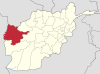 | |
| Populated places | ||
| Landmarks | ||
 | This Herat Province, Afghanistan location article is a stub. You can help Wikipedia by expanding it. |
- v
- t
- e


