Jabal Qada'ah
Mountain in the UAE


Jabal Qada'ah
Location of Jabal Qada'ah
Show map of United Arab Emirates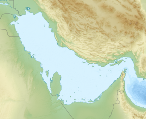
Jabal Qada'ah
Jabal Qada'ah (Persian Gulf)
Show map of Persian Gulf
Jabal Qada'ah
Jabal Qada'ah (West and Central Asia)
Show map of West and Central Asia United Arab Emirates
 Ras al-Khaimah
Jabal Qada'ah[2] (Arabic: جبل قداعة, romanized: Jabal Kidā'ah), also known as Jabal Al Aḩqab,[3] is a mountain located in the Hajar Mountains range, northeast of the United Arab Emirates, in the Emirate of Ras Al Khaimah.
Its summit has an altitude of 1,375 m (4,511 ft), a significant prominence of 460 m (1,510 ft) and a topographic isolation of 4.36 km (2.71 mi),[1] so the elongated and solitary silhouette of the mountain, in the form of a plateau, stands out and is perfectly visible even from a long distance.
The Jabal Qada'ah forms a ridge line that extends in three directions:
- Towards the northwest, with an important subsummit or subpeak of 1,345 m (4,413 ft), with only 45 m (148 ft) of prominence, located 600 m (2,000 ft) away from the main summit, which on some maps is referenced with the name of Jabal Qada'ah (minor). This ridge line then continues to the south and east, with the peaks of Jabal Ar Ra'il (768 m (2,520 ft)),[3] Jabal Ad Diri (612 m (2,008 ft))[3] and other smaller ones, forming part of the northern flank of the drainage divide of Wadi Qada'ah.
- Towards the southeast, the ridge descends to Wadi Qada'ah, near the village of Mak Sikek, one of the most active in the area, located on the banks of the wadi bed.[3]
- And to the north, it extends towards the summit of Jabal As Salwah (980 m (3,220 ft)),[3] forming the eastern flank of the Wadi Ar Ra'ilah sub-basin;[3] west of the villages of Magam[4] and Ra's,[5] popularly known as Deira Al-Hebsi or Deira Al-Habsi, as they were the first settlements of the Habus tribe in this bordering area between the Shihuh tribal areas (located north of the Wadi Bih), and the Habus tribal areas that settled at the south of the wadi,[6] including the Habus tribal area of Banī Sā'ad,[7] to which these populations belonged.[8]

Climbing
There are different routes to ascend to the top of Jabal Qada'ah starting from the west and southwest, and partially using the channels of the Wādī Ar Ra'ilah[3] or the Wādī Al Hayīlah / Wadi Hiyailah[3] (both tributaries of the Wadi Bih), and also from the Wadi Ghail (tributary of the Wadi Qada'ah). None of them are easy, nor can they be considered conventional roads or paths, since to a greater or lesser extent they require the use of climbing techniques and equipment or materials.[9][10][11]
The most accessible and conventional route starts from the Wadi Bih (either from the village of Atmar, initially following the Wadi Atmar), or from the mouth of the Wādī Ar Ra'ilah[3] (sometimes mistakenly called Wadi Haqab).[12] This route follows a donkey path in excellent condition, which is usually used as an access route to the aforementioned villages of Ra's and Magam (Deira Al-Hebsi), and continues south until reaching the col or mountain pass of Jabal Qada'ah East Col (1,120 m (3,670 ft)), located 720 m (2,360 ft) southeast of the main summit.
At that point a short climb of moderate difficulty and without relevant exposure sections begins, until reaching the top of Jabal Qada'ah, where there are ruins of old dry stone constructions, a cairn and remains of a small weather station.
Toponymy
Alternative names: Jabal Kida'ah, Jabal Qida'a, Jabal Qada`a, Jabal Qada`ah, Jabal Qadda`a, Jabal Quda', Jabal Al Ahqab, Jebel Al Ahqab, 'Jabal Al Aḩqab.
The name of Jabal Qada'ah (with the spelling Jabal Qada'a) appears recorded in the documents and maps prepared between 1950 and 1960 by the British Arabist, cartographer, military officer and diplomat Julian F. Walker, on the occasion of the work carried out for the establishment of the borders between the then so-called Trucial States, later completed by the Ministry of Defense of the United Kingdom, with maps at a scale of 1:100,000 published in 1971, and in other previous maps and documents kept in the Archives UK nationals.[13][14]
In the National Atlas of the United Arab Emirates it is referenced with the spelling Jabal Al Aḩqab.[3]
Population
From approximately the beginning of the 19th century, the entire area near Jabal Qada'ah was populated by the Habus tribe,[8][15][16] divided mainly between the tribal areas of Banī Huraymish[17] and Banī Sā‘ad.[7]
See also
- List of mountains in the United Arab Emirates
- List of wadis of the United Arab Emirates
- List of mountains in Oman
- List of wadis in Oman
References
- ^ a b [https://www.peakbagger.com/peak.aspx?pid=-160125 - Jabal Qada'ah, United Arab Emirates
- ^ "Mindat.org - Jabal Qada'ah, Ra's al Khaymah, United Arab Emirates|". www.mindat.org. Retrieved 2024-04-15.
- ^ a b c d e f g h i j Jāmiʻat al-Imārāt al-ʻArabīyah al-Muttaḥidah. Geoprojects (U.K.) Ltd., The National atlas of the United Arab Emirates, Al Ain : United Arab Emirates University - 1993
- ^ "Mindat.org - Magam, Ra's al Khaymah, United Arab Emirates|". www.mindat.org. Retrieved 2024-06-08.
- ^ "Mindat.org - Ra's, Ra's al Khaymah, United Arab Emirates|". www.mindat.org. Retrieved 2024-06-08.
- ^ FO 371/114648 - 1955 - Land and sea boundaries of Trucial Sheikhdoms in Persian Gulf - AREA NO. 3: HABUS LANDS - The National Archives, London, England <https://www.agda.ae/en/catalogue/tna/fo/371/114648/n/46>
- ^ a b "Mindat.org - Banī Sā'ad, Ra's al Khaymah, United Arab Emirates|". www.mindat.org. Retrieved 2024-04-15.
- ^ a b Lancaster, William, 1938- (2011). Honour is in contentment : life before oil in Ras al-Khaimah (UAE) and some neighbouring regions. Lancaster, Fidelity. Berlin: De Gruyter. p. 158. ISBN 978-3-11-022340-8. OCLC 763160662.
{{cite book}}: CS1 maint: multiple names: authors list (link) CS1 maint: numeric names: authors list (link) - ^ "Jebel Qada'ah - Routes 2 and 3 - Ben Robbins". Wikiloc - Trails of the World. Retrieved 2023-05-11.
- ^ "Jebel Qada'ah - Routes 1 and 2 - Ben Robbins". Wikiloc - Trails of the World. Retrieved 2024-06-10.
- ^ "UAE. Jabal Qada'ah to Hebs Village full loop, RAK - Ann_22". Wikiloc - Trails of the World. Retrieved 2024-06-10.
- ^ "Wadi Haqab to Jebel Qada'a Eastern Ascent - Dan Slack". Wikiloc - Trails of the World. Retrieved 2024-06-10.
- ^ "Water supply - Ref. FO 371/163058 - 1962 - The National Archives, London, England". Arabian Gulf Digital Archives. Retrieved 2024-06-09.
- ^ "Trucial States: water resources; with hydrological and groundwater survey - Ref. FO 1016/840 - 1965 - The National Archives, London, England". Arabian Gulf Digital Archives. Retrieved 2024-06-09.
- ^ Tribes of Trucial States coast - 1958- Ref. FO 371/132894 <https://www.agda.ae/en/catalogue/tna/fo/371/132894/n/43>
- ^ "Mindat.org - Al Ḩabūs, Umm al Qaywayn, United Arab Emirates|". www.mindat.org. Retrieved 2024-03-26.
- ^ "Mindat.org - Banī Huraymish, Ra's al Khaymah, United Arab Emirates |". www.mindat.org. Retrieved 2024-03-26.
External links
![]() Media related to Jabal Qada'ah at Wikimedia Commons
Media related to Jabal Qada'ah at Wikimedia Commons

Hills and mountains on the Arabian Peninsula | |
|---|---|
Note: Mountains are sorted in alphabetical order, unless where it concerns ranges. The highest confirmed mountains in each country are indicated with 'HP', and those with the highest peak are indicated with 'HP', bearing in mind that in the UAE, the highest mountain and the mountain with the highest peak are different. Outcrops are indicated with 'OC', and outliers with 'OL', and anticlines with 'AC'. Volcanoes are indicated with 'V', volcanic craters with 'VC', lava fields with 'LF', and volcanic fields with 'VF'. Other notes:
|


