Janovice nad Úhlavou
Town in Plzeň, Czech Republic

Flag

Coat of arms
 Czech Republic
 (2023-01-01)[1]
340 21, 340 22
Janovice nad Úhlavou (German: Janowitz an der Angel) is a town in Klatovy District in the Plzeň Region of the Czech Republic. It has about 2,400 inhabitants.
Administrative parts
Villages of Dolní Lhota, Dubová Lhota, Hvízdalka, Ondřejovice, Petrovice nad Úhlavou, Plešiny, Rohozno, Spůle, Vacovy and Veselí are administrative parts of Janovice nad Úhlavou.
Geography
Janovice nad Úhlavou is located about 5 km (3 mi) west of Klatovy and 44 km (27 mi) south of Plzeň. It lies mostly in the Švihov Highlands, but the municipal territory extends also to the Bohemian Forest Foothills in the south and west. The highest point is the hill Na Porovnání at 639 m (2,096 ft) above sea level. The town is situated at the confluence of the Úhlava River and Jelenka Stream. Podstránský Pond is located in the northern part of the territory.
History
The first written mention of Janovice nad Úhlavou is from 1290. In the second half of the 14th century, the settlement became a town.[2]
Demographics
|
|
| ||||||||||||||||||||||||||||||||||||||||||||||||||||||
| Source: Censuses[3][4] | ||||||||||||||||||||||||||||||||||||||||||||||||||||||||
Transport
Janovice nad Úhlavou is located on the railway line Prague–Plzeň–Železná Ruda and thus has a direct connection to the capital. The line from Klatovy to Domažlice also passes through the town.[5]
Sights
The most valuable building is the Church of Saint John the Baptist. It is an early Gothic building from around 1260. In 1764, it was baroque modified and the tower was added.[2][6]
There is a Jewish cemetery from the early 18th century.[2]
Notable people
- Karel Pacner (1936–2021), journalist and writer
Gallery
-
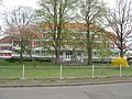 Primary school
 -
 Sokol building
 -
 Church of Saint John the Baptist
 -
 Old town hall


References
- ^ "Population of Municipalities – 1 January 2023". Czech Statistical Office. 2023-05-23.
- ^ a b c "Přehled turistických zajímavostí v okolí Klatov" (in Czech). ŠumavaNet.cz. Retrieved 2022-12-04.
- ^ "Historický lexikon obcí České republiky 1869–2011 – Okres Klatovy" (in Czech). Czech Statistical Office. 2015-12-21. pp. 11–12.
- ^ "Population Census 2021: Population by sex". Public Database. Czech Statistical Office. 2021-03-27.
- ^ "Detail stanice Janovice n.Úhlavou" (in Czech). České dráhy. Retrieved 2023-07-05.
- ^ "Kostel sv. Jana Křtitele" (in Czech). National Heritage Institute. Retrieved 2022-12-04.
External links
Wikimedia Commons has media related to Janovice nad Úhlavou.
- Official website
- v
- t
- e
- Běhařov
- Běšiny
- Bezděkov
- Biřkov
- Bolešiny
- Břežany
- Budětice
- Bukovník
- Čachrov
- Černíkov
- Červené Poříčí
- Chanovice
- Chlistov
- Chudenice
- Chudenín
- Číhaň
- Čímice
- Dešenice
- Dlažov
- Dlouhá Ves
- Dobršín
- Dolany
- Domoraz
- Dražovice
- Frymburk
- Hamry
- Hartmanice
- Hejná
- Hlavňovice
- Hnačov
- Horažďovice
- Horská Kvilda
- Hrádek
- Hradešice
- Janovice nad Úhlavou
- Javor
- Ježovy
- Kašperské Hory
- Kejnice
- Klatovy
- Klenová
- Kolinec
- Kovčín
- Křenice
- Kvášňovice
- Lomec
- Malý Bor
- Maňovice
- Měčín
- Mezihoří
- Mlýnské Struhadlo
- Mochtín
- Modrava
- Mokrosuky
- Myslív
- Myslovice
- Nalžovské Hory
- Nehodiv
- Nezamyslice
- Nezdice na Šumavě
- Nýrsko
- Obytce
- Olšany
- Ostřetice
- Pačejov
- Petrovice u Sušice
- Plánice
- Podmokly
- Poleň
- Prášily
- Předslav
- Rabí
- Rejštejn
- Slatina
- Soběšice
- Srní
- Strašín
- Strážov
- Sušice
- Svéradice
- Švihov
- Tužice
- Týnec
- Újezd u Plánice
- Velhartice
- Velké Hydčice
- Velký Bor
- Vřeskovice
- Vrhaveč
- Zavlekov
- Zborovy
- Železná Ruda
- Žichovice
- Žihobce
| Authority control databases: National |
|
|---|


