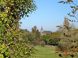
La Bruyère, Belgium
Municipality in Namur Province, Belgium
Municipality in French Community, Belgium
La Bruyère Les Brouyires (Walloon) | |
|---|---|
Municipality | |
 | |
 Flag  Coat of arms | |
Location of La Bruyère  | |
  La Bruyère Location in Belgium Location of La Bruyère in Namur Province  | |
| Coordinates: 50°30′N 04°48′E / 50.500°N 4.800°E / 50.500; 4.800 | |
| Country |  Belgium Belgium |
| Community | French Community |
| Region | Wallonia |
| Province | Namur |
| Arrondissement | Namur |
| Government | |
| • Mayor | Yves Depas (PS) |
| • Governing party/ies | Ecolo - D&B - PS |
| Area | |
| • Total | 53.04 km2 (20.48 sq mi) |
| Population (2018-01-01)[1] | |
| • Total | 9,226 |
| • Density | 170/km2 (450/sq mi) |
| Postal codes | 5080-5081 |
| NIS code | 92141 |
| Area codes | 081 |
| Website | www.labruyère.be |
La Bruyère (French: [la bʁɥijɛʁ] or [la bʁujɛʁ]; Walloon: Les Brouyires) is a municipality of Wallonia located in the province of Namur, Belgium.
The municipality is composed of the following districts: Bovesse, Émines, Meux, Rhisnes, Saint-Denis-Bovesse, Villers-lez-Heest, and Warisoulx. Rhisnes is the administrative seat of the municipality.

See also
References
- ^ "Wettelijke Bevolking per gemeente op 1 januari 2018". Statbel. Retrieved 9 March 2019.
External links
 Media related to La Bruyère, Namur at Wikimedia Commons
- Official website Archived 2020-12-03 at the Wayback Machine (in French)


Authority control databases | |
|---|---|
| International |
|
| National |
|
 | This Namur Province location article is a stub. You can help Wikipedia by expanding it. |
- v
- t
- e


