Mähring
Municipality in Bavaria, Germany

Coat of arms
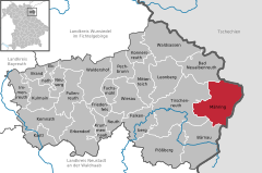
Location of Mähring within Tirschenreuth district
(2022-12-31)[2]
95695
Mähring is a municipality in the district of Tirschenreuth in Bavaria, Germany.
References
- ^ Liste der ersten Bürgermeister/Oberbürgermeister in kreisangehörigen Gemeinden, Bayerisches Landesamt für Statistik, 15 July 2021.
- ^ Genesis Online-Datenbank des Bayerischen Landesamtes für Statistik Tabelle 12411-003r Fortschreibung des Bevölkerungsstandes: Gemeinden, Stichtag (Einwohnerzahlen auf Grundlage des Zensus 2011) (Hilfe dazu).
- v
- t
- e
Towns and municipalities in Tirschenreuth (district)
- Bad Neualbenreuth
- Bärnau
- Brand
- Ebnath
- Erbendorf
- Falkenberg
- Friedenfels
- Fuchsmühl
- Immenreuth
- Kastl
- Kemnath
- Konnersreuth
- Krummennaab
- Kulmain
- Leonberg
- Mähring
- Mitterteich
- Neusorg
- Pechbrunn
- Plößberg
- Pullenreuth
- Reuth bei Erbendorf
- Tirschenreuth
- Waldershof
- Waldsassen
- Wiesau

Authority control databases | |
|---|---|
| International |
|
| National |
|
 | This Tirschenreuth district location article is a stub. You can help Wikipedia by expanding it. |
- v
- t
- e


