Mandera
City in Kenya
Mandera Mandheer | |
|---|---|
City | |
 | |
03°55′N 41°50′E / 3.917°N 41.833°E / 3.917; 41.833 | |
| Country |  Kenya Kenya |
| County | Mandera |
| Population (2019) | |
| • Total | 114,718 |
| [1] | |
| Time zone | UTC+3 (EAT) |
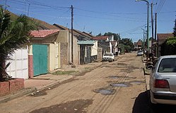
Mandera (Somali: Mandheera) is the capital of Mandera County in the former North Eastern Province of Kenya. It is situated at around 3°55′N 41°50′E / 3.917°N 41.833°E / 3.917; 41.833, near the borders with Somalia and Ethiopia.
Districts
Mandera is the capital of the Mandera District.[2]
As a whole, it used to constitute one district in previous administrations, which is now divided into six sub-counties and Constituencies; namely,
- Mandera East which represents Mandera Town
- Mandera Central
- Mandera West
- Mandera North
- Banissa
- Elwak
- Lafey
The county occupies an area of 26,744 km2.[2]
Among the notable incident of Mandera history was the Rhamu Incident of the 1977 in which Somali military invaded Ethiopian defences from the Kenyan side in which a force of 1500 Somali soldiers attacked a border post, and killed 30 Kenyan police officers and soldiers. The Somali army successfully crossed into the Sidamo Region of Ethiopia in the so called Ogaden War.[3]
Demographics
Most of Mandera's inhabitants are overwhelmingly ethnic Somali.
Climate
| Mandera | ||||||||||||||||||||||||||||||||||||||||||||||||||||||||||||
|---|---|---|---|---|---|---|---|---|---|---|---|---|---|---|---|---|---|---|---|---|---|---|---|---|---|---|---|---|---|---|---|---|---|---|---|---|---|---|---|---|---|---|---|---|---|---|---|---|---|---|---|---|---|---|---|---|---|---|---|---|
| Climate chart (explanation) | ||||||||||||||||||||||||||||||||||||||||||||||||||||||||||||
| ||||||||||||||||||||||||||||||||||||||||||||||||||||||||||||
| ||||||||||||||||||||||||||||||||||||||||||||||||||||||||||||
Mandera's climate is categorized as arid under the Köppen climate classification. Temperatures tend to be hot throughout the year. Daily temperatures are typically above 30 °C (86 °F), while at night, they can fall to 20 °C (68 °F). Precipitation is extremely low, with the area receiving a minimal amount of rain. Droughts are not unusual, often resulting in significant loss of livestock in rural areas where pastoralism is common.[4]
See also
- Mandera triangle for the border region disputed between Kenya, Somalia and Ethiopia, centered on the city of Mandera
References
External links
- Districts of Kenya
- v
- t
- e
 First- and second-level administrative divisions of Kenya
(since March 2013)
- Baringo (30)
- Bomet (36)
- Bungoma (39)
- Busia (40)
- Elgeyo-Marakwet (28)
- Embu (14)
- Garissa (07)
- Homa Bay (43)
- Isiolo (11)
- Kajiado (34)
- Kakamega (37)
- Kericho (35)
- Kiambu (22)
- Kilifi (03)
- Kirinyaga (20)
- Kisii (45)
- Kisumu (42)
- Kitui (15)
- Kwale (02)
- Laikipia (31)
- Lamu (05)
- Machakos (16)
- Makueni (17)
- Mandera (09)
- Marsabit (10)
- Meru (12)
- Migori (44)
- Mombasa (01)
- Murang'a (21)
- Nairobi (47)
- Nakuru (32)
- Nandi (29)
- Narok (33)
- Nyamira (46)
- Nyandarua (18)
- Nyeri (19)
- Samburu (25)
- Siaya (41)
- Taita-Taveta (06)
- Tana River (04)
- Tharaka-Nithi (13)
- Trans-Nzoia (26)
- Turkana (23)
- Uasin Gishu (27)
- Vihiga (38)
- Wajir (08)
- West Pokot (24)
and towns
- Nairobi (capital)
- Athi River
- Baragoi
- Bomet
- Bungoma
- Busia
- Chuka
- Eldoret
- Embu
- Garissa
- Hola
- Homa Bay
- Isiolo
- Iten
- Kabarnet
- Kajiado
- Kakamega
- Kapsabet
- Kangundo - Tala
- Kapenguria
- Karuri
- Kericho
- Kerugoya
- Kiambu
- Kibwezi
- Kikuyu
- Kilifi
- Kisii
- Kisumu
- Kitale
- Kitengela
- Kitui
- Kwale
- Limuru
- Lodwar
- Lokichogio
- Loiyangalani
- Lamu
- Machakos
- Makindu
- Malindi
- Mandera
- Maralal
- Marsabit
- Masii
- Meru
- Mombasa
- Moyale
- Mtito Andei
- Mumias
- Murang'a
- Mutomo
- Mwingi
- Naivasha
- Nakuru
- Namanga
- Nanyuki
- Narok
- Nyahururu
- Nyamira
- Nyeri
- Ol Kalou
- Ongata Rongai
- Ruiru
- Siaya
- Thika
- Vihiga
- Voi
- Wajir
- Webuye
- Wote
- Wundanyi


