Marjeyoun District
District in Nabatiyeh Governorate, Lebanon
33°21′43″N 35°35′23″E / 33.36194°N 35.58972°E / 33.36194; 35.58972 Lebanon
(31 December 2017)

The Marjeyoun District is a district in the Nabatieh Governorate of Lebanon. The capital of the district is Marjeyoun.
Marjeyoun stands at a hill facing Mount Hermon to the East, with Beaufort castle. The Litani River and Mount Amel are to the West, The Rihan, Niha and the Lebanon Mountain Range to the North and the fertile plains of Sahil Marjeyoun that extends into Northern Israel between the Galilee finger and plains immediately underneath the Golan Heights.
Photos of Marjeyoun
Marjeyoum Photo Album
Baladiyat Marjeyoun photo gallery
A view of Marjeyoun by satellite
References
- ^ UN Records
External links
- Khiam Official website
- The Official Marjeyoun Municipality
- www.marjeyoun.net
- v
- t
- e
Districts of Lebanon
- Akkar

- Baalbek
- Hermel
- Bint Jbeil
- Hasbaya
- Marjeyoun
- Nabatieh
 Marjeyoun District, Nabatieh Governorate Marjeyoun District, Nabatieh Governorate | ||
|---|---|---|
| Capital | 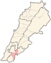 | |
| Towns and villages | ||
| Other | ||
 | This Lebanon location article is a stub. You can help Wikipedia by expanding it. |
- v
- t
- e


