Mghayreh
Village in Keserwan-Jbeil, Lebanon
Mghayreh مغيري Mughayri or Mughairi | |
|---|---|
Village | |
| 34°5′46″N 35°52′21″E / 34.09611°N 35.87250°E / 34.09611; 35.87250 | |
| Country | Lebanon |
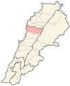
| Governorate | Keserwan-Jbeil |
| District | Byblos |
| Area | |
| • Total | 2.63 km2 (1.02 sq mi) |
| Elevation | 1,160 m (3,810 ft) |

Mghayreh (Arabic: مغيره,المغيري also spelled Mughayri) is a municipality in the Byblos District of Keserwan-Jbeil Governorate, Lebanon. It is 82 kilometers north of Beirut. Mghayreh has an average elevation of 1,300 meters above sea level and a total land area of 263 hectares. Its inhabitants are predominantly Maronite Catholics and Shia Muslims.[1] It's situated on the slopes of Joubbat El Mnaitra and is bordered by Aqoura to the south, Afqa to the west and Qartaba to the east.

History
Patriarch and 17th century historian Estephan El Douaihy mentions that the monastery of Saint-Jeries-el-Azzra became the seat of the Maronite Patriarchate in 939.
Archaeology
Mghayreh's oldest ruins include the 'blue convent', a Roman temple dedicated to Adonis and Astarte in the 2nd century AD. The temple was also dedicated to the goddess Diana.
The town's Church of Our Lady of Yanouh dates back to the Crusader period.
Agriculture
Mghayreh produces many varieties of apples thanks to its temperate summer climate. Varieties include the Golden and Starking apples. Other agricultural produces include apricot, plum, peach, pear, pomegranate and other fruits.
References
Wikimedia Commons has media related to Mghayra.
- ^ "Elections municipales et ikhtiariah au Mont-Liban" (PDF). Localiban. Localiban. 2010. p. 19. Archived from the original (pdf) on 2015-07-24. Retrieved 2016-02-12.
- v
- t
- e

Capital: Byblos
- Aabaydat
- Almat el-Chmaliyeh
- Almat el-Jnoubiyeh
- Amsheet
- Annaya
- Aqoura
- Adonis
- Afqa
- Ain ed-Delbeh
- Ain el-Ghouaybeh
- Ain Jrain
- Ain Kfaa
- Bazyoun
- Bchilleh
- Beer el-Hit
- Behdidat
- Bejjeh
- Bekhaaz
- Berbara
- Beithabbak
- Bichtlida -Fidar
- Bentaël
- Birket Hjoula
- Blat
- Boulhos
- Brayj
- Byblos
- Chatine
- Chikhane
- Chmout
- Edde
- Ehmej
- Fatreh
- Ferhet
- Fidar
- Fghal
- Ghabat
- Ghalboun
- Gharzouz
- Ghorfine
- Habil
- Halat
- Haqel
- Hay el-Arabeh
- Hbaline
- Hboub
- Hdayneh
- Hjoula
- Hosrayel
- Hsarat
- Hsoun
- Jaj
- Janneh
- Jeddayel
- Jenjol
- Jlisseh
- Jouret el-Qattine
- Kafr
- Kfar Baal
- Kfar Hitta
- Kfar Kiddeh
- Kfar Masshoun
- Kfar Qouas
- Kfoun
- Laqlouq
- Lassa
- Lehfed
- Maad
- Majdel
- Marj
- Mastita
- Mayfouq
- Mazraat es-Siyad
- Mechane
- Mghayreh
- Mish Mish
- Mounsef
- Nahr Ibrahim
- Qahmez
- Qartaba
- Qartaboun
- Qorqraiya
- Ram
- Ras Osta
- Rihaneh
- Seraaita
- Souaneh
- Tartej
- Tourzaiya
- Yanouh
- Zebdine
- Abraham River
- Byblos Castle
- Jaj Cedar National Park
- Laqlouq skiing resort
- Royal necropolis of Byblos
- Temple of Baalat Gebal
- Temple of the Obelisks
 | This Lebanon location article is a stub. You can help Wikipedia by expanding it. |
- v
- t
- e


