Olho d'Água do Casado
Municipality in Northeast, Brazil
9°32′10″S 37°17′38″W / 9.536°S 37.294°W / -9.536; -37.294 (2020)
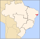
Olho d'Água do Casado is a municipality located in the western of the Brazilian state of Alagoas. Its population is 9,441 (2020)[1] and its area is 323 square kilometres (125 sq mi).[2]
The municipality holds part of the 26,736 hectares (66,070 acres) Rio São Francisco Natural Monument, which protects the spectacular canyons of the São Francisco River between the Paulo Afonso Hydroelectric Complex and the Xingó Dam.[3]
References
- v
- t
- e
Capital: Maceió
- Arapiraca
- Campo Grande
- Coité do Nóia
- Craíbas
- Feira Grande
- Girau do Ponciano
- Lagoa da Canoa
- Limoeiro de Anadia
- São Sebastião
- Taquarana

- Delmiro Gouveia
- Olho d'Água do Casado
- Piranhas
 | This Alagoas, Brazil location article is a stub. You can help Wikipedia by expanding it. |
- v
- t
- e


