Peins
Village in Friesland, Netherlands
53°12′20″N 5°35′39″E / 53.20556°N 5.59417°E / 53.20556; 5.59417 (2021)[1]
8812[1]
Peins is a village in Waadhoeke in the province of Friesland, the Netherlands. It had a population of around 170 in January 2018.[3] Up to 2018, the village was part of the Franekeradeel municipality.[4]
History
The village was first mentioned in the 13th century Pesinghe, and means "settlement of the people of Pese (person)".[5] Peins is a terp (artificial living hill) living which probably dates from the beginning of our era. The clay wall to Franeker which later turned into a road. The Dutch Reformed church dates from around 1300 and was extensively modified in 1865.[6] The tower was replaced in 1912.[4]
Peins was home to 168 people in 1840.[4]
Gallery
-
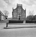 House in Peins

References
- ^ a b c "Kerncijfers wijken en buurten 2021". Central Bureau of Statistics. Retrieved 4 April 2022.
- ^ "Postcodetool for 8812JH". Actueel Hoogtebestand Nederland (in Dutch). Het Waterschapshuis. Retrieved 4 April 2022.
- ^ "Peins (Waadhoeke, Friesland / Fryslân, Netherlands) - Population Statistics, Charts, Map, Location, Weather and Web Information". www.citypopulation.de. Retrieved 2023-09-29.
- ^ a b c "Peins". Plaatsengids (in Dutch). Retrieved 4 April 2022.
- ^ "Peins - (geografische naam)". Etymologiebank (in Dutch). Retrieved 4 April 2022.
- ^ Ronald Stenvert & Sabine Broekhoven (2000). "Peins" (in Dutch). Zwolle: Waanders. ISBN 90 400 9476 4. Retrieved 4 April 2022.
- v
- t
- e
Populated places in the municipality of Waadhoeke
- Franeker
- Former municipalities: Franekeradeel
- het Bildt
- Menameradiel
- Achlum
- Alde Leie (small part)
- Baaium
- Berltsum
- Bitgum
- Bitgummole
- Blessum
- Boer
- Boksum
- Deinum
- Dongjum
- Dronryp
- Firdgum
- Herbaijum
- Hitzum
- Ingelum
- Klooster-Lidlum
- Marsum
- Menaam
- Minnertsga
- Nij Altoenae
- Oosterbierum
- Oudebildtzijl
- Peins
- Pietersbierum
- Ried
- Schalsum
- Sexbierum
- Sint Annaparochie
- Sint Jacobiparochie
- Skingen
- Slappeterp
- Spannum
- Tzum
- Tzummarum
- Vrouwenparochie
- Westhoek
- Wier
- Winsum
- Wjelsryp
- Zweins
 | This Friesland location article is a stub. You can help Wikipedia by expanding it. |
- v
- t
- e


