Pinkafeld
You can help expand this article with text translated from the corresponding article in German. (July 2013) Click [show] for important translation instructions.
- View a machine-translated version of the German article.
- Machine translation, like DeepL or Google Translate, is a useful starting point for translations, but translators must revise errors as necessary and confirm that the translation is accurate, rather than simply copy-pasting machine-translated text into the English Wikipedia.
- Do not translate text that appears unreliable or low-quality. If possible, verify the text with references provided in the foreign-language article.
- You must provide copyright attribution in the edit summary accompanying your translation by providing an interlanguage link to the source of your translation. A model attribution edit summary is
Content in this edit is translated from the existing German Wikipedia article at [[:de:Pinkafeld]]; see its history for attribution. - You may also add the template
{{Translated|de|Pinkafeld}}to the talk page. - For more guidance, see Wikipedia:Translation.
Place in Burgenland, Austria

Coat of arms
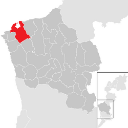
Location within Oberwart district
(2018-01-01)[2]
7423
Pinkafeld (Hungarian: Pinkafő, Croatian: Pinkafelj, Slovene: Pinkafel, Romani: Pinkafa) is a city in Burgenland in Austria and the second largest settlement (after Oberwart) in the district Oberwart.
Geography
Parts of the commune are Hochart, Gfangen, Alt-Pinkafeld, Nord-Pinkafeld and Pinkafeld Stadt. Pinkafeld lies on the course of the river Pinka, which gives the town its name.
History
- 860 - The first mention of Pinkafeld ("Peincahu")
- 1289 - The destruction of Pinkafeld ("Pinkafelde")
- 1397 - Pinkafeld is no longer part of Bernstein
- 1532 - The Ottomans destroy Pinkafeld
- 1658 - Ádám Batthyány constructs a castle in Pinkafeld
- 1921 - Pinkafeld becomes part of Austria, no longer under control by Hungary
Population
| Year | Pop. | ±% |
|---|---|---|
| 1697 | 1,500 | — |
| 1804 | 1,821 | +21.4% |
| 1844 | 2,351 | +29.1% |
| 1869 | 2,683 | +14.1% |
| 1880 | 3,080 | +14.8% |
| 1890 | 3,078 | −0.1% |
| 1900 | 3,156 | +2.5% |
| 1910 | 3,089 | −2.1% |
| 1923 | 2,776 | −10.1% |
| 1934 | 3,788 | +36.5% |
| 1939 | 3,695 | −2.5% |
| 1951 | 3,753 | +1.6% |
| 1961 | 4,081 | +8.7% |
| 1971 | 4,620 | +13.2% |
| 1981 | 4,792 | +3.7% |
| 1991 | 5,010 | +4.5% |
| 2001 | 5,181 | +3.4% |
| 2011 | 5,328 | +2.8% |
Politics
The mayor is Kurt Maczek of the SPÖ (Social Democratic Party of Austria). The vice-Mayor is Thomas Pickl of the ÖVP (Austrian People's Party). In the representation, which has 25 mandates, the SPÖ has 16 mandates and the ÖVP has 9.
Events
In 2012, the FCI European Open Junior Agility competition was hosted in Pinkafeld.
Notable people from Pinkafeld
- Ádám Batthyány (1610–1659), a Hungarian count of the Batthyány family; built a castle locally
- Carl Vaugoin (1873–1949), politician; eleventh Chancellor of Austria in 1930.
- Norbert Hofer (born 1971), an Austrian politician; raised in Pinkafeld
References
Wikimedia Commons has media related to Pinkafeld.
- v
- t
- e
Municipalities in the district of Oberwart
- Bad Tatzmannsdorf
- Badersdorf
- Bernstein im Burgenland
- Deutsch Schützen-Eisenberg
- Grafenschachen
- Großpetersdorf
- Hannersdorf
- Jabing
- Kemeten
- Kohfidisch
- Litzelsdorf
- Loipersdorf-Kitzladen
- Mariasdorf
- Markt Allhau
- Markt Neuhodis
- Mischendorf
- Neustift an der Lafnitz
- Oberdorf im Burgenland
- Oberschützen
- Oberwart
- Pinkafeld
- Rechnitz
- Riedlingsdorf
- Rotenturm an der Pinka
- Schachendorf
- Schandorf
- Stadtschlaining
- Unterkohlstätten
- Unterwart
- Weiden bei Rechnitz
- Wiesfleck
- Wolfau
Authority control databases | |
|---|---|
| International |
|
| National |
|
| Geographic |
|
 | This Burgenland location article is a stub. You can help Wikipedia by expanding it. |
- v
- t
- e


