Tiapoum
Place in Comoé, Ivory Coast
5°8′N 3°1′W / 5.133°N 3.017°W / 5.133; -3.017 Ivory Coast
 (2014)[1]
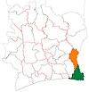
Tiapoum is a town in south-eastern Ivory Coast. It is a sub-prefecture of and the seat of Tiapoum Department in Sud-Comoé Region, Comoé District. Tiapoum is also a commune. The town sits on the north shore of the Tano River, which in this area forms the border between Ivory Coast and Ghana. In 2014, the population of the sub-prefecture of Tiapoum was 25,072.[2]
Villages
The eighteen villages of the sub-prefecture of Tiapoum and their population in 2014 were:[2]
- Assué 1 (339)
- Assué 2 (587)
- Assué Gnamboa (332)
- Assué Mossi (1 347)
- Tiapoum (4 567)
- Allangouanou (838)
- Andjé (377)
- Atchimanou (221)
- Bodoua (1 121)
- Eboinda (891)
- Eboko (2 071)
- Edjambo (3 457)
- Famien Eborobo (332)
- Frambo (2 533)
- Kodjokro (766)
- Kouassiblékro (388)
- N'guiémé (3 795)
- N'zobénou (1 110)
References
- ^ "Côte d'Ivoire". geohive.com. Retrieved 8 December 2015.
- ^ a b "RGPH 2014, Répertoire des localités, Région Sud-Comoé" (PDF). ins.ci. Retrieved 5 August 2019.
- v
- t
- e
Departments and sub-prefectures of Sud-Comoé Region, Comoé DistrictRegional seat: Aboisso
* also a commune
 | This Comoé District location article is a stub. You can help Wikipedia by expanding it. |
- v
- t
- e


