Veintiséis de Octubre District
District in Piura, Peru

Flag

Coat of arms
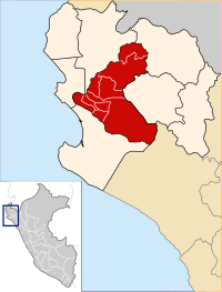
Map of the Piura Province
 Peru
PeruVeintiséis de Octubre District is one of the districts of the province Piura in Peru. On February 2, 2013, the president of Peru Ollanta Humala Tasso promulgated the law Ley 29991 of territorial demarcation and organization of the province of Piura, which in its second article created the district Veintiséis de Octubre.[1]
References
- ^ Diario El Tiempo (May 18, 2012). "Sector Oeste a un paso de ser Jdistrito" (in Spanish). Archived from the original on February 17, 2013. Retrieved February 3, 2013.
External links
- INEI Perú
- v
- t
- e

- Districts of Piura Region
- Peru

- Piura
- Castilla
- Catacaos
- Cura Mori
- El Tallán
- La Arena
- La Unión
- Las Lomas
- Tambo Grande
- Veintiséis de Octubre
 | This Piura Region geography article is a stub. You can help Wikipedia by expanding it. |
- v
- t
- e
5°10′37″S 80°40′51″W / 5.17694°S 80.68083°W / -5.17694; -80.68083


