Vila Nova de Poiares
Municipality in Centro, Portugal

Flag

Coat of arms
 Portugal
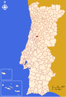
 (2011)
Vila Nova de Poiares (Portuguese pronunciation: [ˈvilɐ ˈnɔvɐ ðɨ poˈjaɾɨʃ] ⓘ) is a municipality in the Coimbra district, in Portugal. The population in 2011 was 7,281,[1] in an area of 84.45 km².[2]
Parishes
Administratively, the municipality is divided into 4 civil parishes (freguesias):[3]
- Arrifana
- Lavegadas
- Santo André de Poiares
- São Miguel de Poiares
International relations
Vila Nova de Poiares is twinned with:
 Mielec in Poland[4]


Douchy-Les-Mines, France
References
- ^ Instituto Nacional de Estatística
- ^ Áreas das freguesias, concelhos, distritos e país
- ^ Diário da República. "Law nr. 11-A/2013, page 552 136" (pdf) (in Portuguese). Retrieved 5 August 2014.
- ^ "Mielec- Miasta Partnerskie" [Mielec - Partnership Cities]. Oficjalny serwis Urzędu Miejskiego w Mielcu [Mielec City Council]
 (in Polish). Archived from the original on 2013-08-21. Retrieved 2013-08-25.

External links
Wikimedia Commons has media related to Vila Nova de Poiares.
- Photos from Vila Nova de Poiares
- v
- t
- e
Municipalities of Coimbra District
- Arganil
- Cantanhede
- Coimbra
- Condeixa-a-Nova
- Figueira da Foz
- Góis
- Lousã
- Mira
- Miranda do Corvo
- Montemor-o-Velho
- Oliveira do Hospital
- Pampilhosa da Serra
- Penacova
- Penela
- Soure
- Tábua
- Vila Nova de Poiares
Authority control databases | |
|---|---|
| International |
|
| Geographic |
|
 | This Coimbra location article is a stub. You can help Wikipedia by expanding it. |
- v
- t
- e


