Wittelshofen
Municipality in Bavaria, Germany

Coat of arms
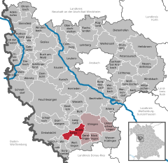
Location of Wittelshofen within Ansbach district
(2020–26) Werner Leibrich[1]
(2022-12-31)[2]
91749
Wittelshofen is a municipality in the district of Ansbach in Bavaria in Germany.
Geography
The municipality is located near the delta of the Sulzach into the Wörnitz at the foot of the Hesselberg mountains. The municipality is divided into the following parts:
- Wittelshofen
- Grüb
- Dühren
- Gelshofen
- Illenschwang
- Neumühle
- Obermichelbach
- Untermichelbach
The neighbour municipalities are (starting in the north clockwise):
- Langfurth
- Ehingen
- Gerolfingen
- Weiltingen
- Wilburgstetten
- Dinkelsbühl
History
The place is mentioned for the first time in 1274 as Witelshoven.
Coat of arms
The coat of arms of Wittelshofen shows a lily on a blue background. Over it is a black-silver quartering. The lily was the coat of arms symbol of Gumbert in Ansbach. The blue background in represents the confluence of the Sulzach and the Wörnitz.
Religious denominations
Jewish municipality
In 1716, there were already 30 Jewish families in Wittelshofen. The Jewish population reached its peak about 1809/10 with 282 persons. Afterwards the number went throughout and drift constantly back (1910 42, 1933 17 Jewish inhabitants). At least 18 Jews from Wittelshofen were killed in concentration camps between 1941 and 1945.
Museums
- Roman park Ruffenhofen
- Local history museum Heinrich Zoller
Buildings
In the old centre of Wittelshofen stands the Martinskirche. At the edge of the settlement area, which is because of the mountain-slope, kath. the holy cross church stands. Illenschwang with its former military church, Obermichelbach with its Michaelskirche and Untermichelbach with its pc. Leonard geweihten church invite to staying. A Kleinod is the Dühren lying in a pictorial side valley of the Sulzach. Its pc. Michaelskirchlein saves Fresken from that 14th and 15th centuries, which only 1985 were discovered and partly opened.
References
- ^ Liste der ersten Bürgermeister/Oberbürgermeister in kreisangehörigen Gemeinden, Bayerisches Landesamt für Statistik, 15 July 2021.
- ^ Genesis Online-Datenbank des Bayerischen Landesamtes für Statistik Tabelle 12411-003r Fortschreibung des Bevölkerungsstandes: Gemeinden, Stichtag (Einwohnerzahlen auf Grundlage des Zensus 2011).
- v
- t
- e
Towns and municipalities in Ansbach (district)
- Adelshofen
- Arberg
- Aurach
- Bechhofen
- Bruckberg
- Buch am Wald
- Burgoberbach
- Burk
- Colmberg
- Dentlein
- Diebach
- Dietenhofen
- Dinkelsbühl
- Dombühl
- Dürrwangen
- Ehingen
- Feuchtwangen
- Flachslanden
- Gebsattel
- Gerolfingen
- Geslau
- Heilsbronn
- Herrieden
- Insingen
- Langfurth
- Lehrberg
- Leutershausen
- Lichtenau
- Merkendorf
- Mitteleschenbach
- Mönchsroth
- Neuendettelsau
- Neusitz
- Oberdachstetten
- Ohrenbach
- Ornbau
- Petersaurach
- Röckingen
- Rothenburg ob der Tauber
- Rügland
- Sachsen
- Schillingsfürst
- Schnelldorf
- Schopfloch
- Steinsfeld
- Unterschwaningen
- Wassertrüdingen
- Weidenbach
- Weihenzell
- Weiltingen
- Wettringen
- Wieseth
- Wilburgstetten
- Windelsbach
- Windsbach
- Wittelshofen
- Wolframs-Eschenbach
- Wörnitz

Authority control databases | |
|---|---|
| International |
|
| National |
|


