Yozgat Province
Province of Turkey
Province in Turkey
Yozgat Province Yozgat ili | |
|---|---|
Province | |
 Sunset in Yozgat Fatih Nature Park | |
 Location of the province within Turkey | |
| Country | Turkey |
| Seat | Yozgat |
| Government | |
| • Governor | Ziya Polat |
| Area | 13,690 km2 (5,290 sq mi) |
| Population (2022)[1] | 418,442 |
| • Density | 31/km2 (79/sq mi) |
| Time zone | UTC+3 (TRT) |
| Area code | 0354 |
| Website | www |
Yozgat Province (Turkish: Yozgat ili) is a province in central Turkey. Its area is 13,690 km2,[2] and its population is 418,442 (2022).[1] Its adjacent provinces are Çorum to the northwest, Kırıkkale to the west, Kırşehir to the southwest, Nevşehir to the south, Kayseri to the southeast, Sivas to the east, Tokat to the northeast, and Amasya to the north. The provincial capital is Yozgat.
Toponymy
It was previously called Bozok and renamed Yozgat in 1927.
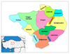
Districts

Yozgat province is divided into 14 districts (capital district in bold):
Places of interest
- Yozgat Pine Grove National Park
- Yozgat Castle (Historical Behramşah Castle and Tombs)
- Roma Kral Kızı Hamamı
- Yozgat Fatih Tabiat Parkı
- Büyük Camii (Çapanoğlu Mosque)
Mosques
- Fatih Camii, a former church in the city centre
- Yortanlı Sitesi, a former church in the city centre
See also
References
External links
![]() Media related to Yozgat Province at Wikimedia Commons
Media related to Yozgat Province at Wikimedia Commons
- (in Turkish) Yozgat official website
- (in Turkish) Yozgat governor's official website
- (in Turkish) Yozgat municipality's official website
- (in English) Yozgat weather forecast information
39°40′10″N 35°16′09″E / 39.66944°N 35.26917°E / 39.66944; 35.26917
- v
- t
- e
Yozgat Province of Turkey

| Istanbul | |
|---|---|
| West Marmara | |
| Aegean | |
| East Marmara | |
| West Anatolia | |
| Mediterranean | |
| Central Anatolia | |
| West Black Sea | |
| East Black Sea | |
| Northeast Anatolia | |
| Central East Anatolia | |
| Southeast Anatolia | |
Metropolitan municipalities are bolded.
Authority control databases | |
|---|---|
| International |
|
| National |
|
| Geographic |
|
 | This geographical article about a location in Yozgat Province, Turkey is a stub. You can help Wikipedia by expanding it. |
- v
- t
- e


