Carbon County (Wyoming)
| Carbon County i Wyoming | |||
|---|---|---|---|
 | |||
| Grunnlagt | 1868 | ||
| Oppkalt etter | kull, karbon | ||
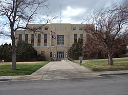
| Fylkessete | Rawlins | ||
| Areal - Totalt - Land - Vann | 20 626,74 km² 20 450,91 km² 175,83 km² | ||
| Befolkning - Tetthet | 15 325 (2006) 0,74 innb./km² | ||
 Carbon County 41°41′N 106°56′V | |||
Carbon County på Commons | |||
Carbon County er et fylke i den amerikanske delstaten Wyoming. Det ligger sør i staten og det grenser til Sweetwater County i vest, Fremont County i nordvest, Natrona County i nord, Converse County i nordøst og mot Albany County i øst. Det har også grense mot delstaten Colorado i sør.
Carbon Countys totale areal er 20 627 km² hvorav 176 km² er vann. I 2000 hadde fylket 15 639 innbyggere og administrasjonssenteret ligger i byen Rawlins[1] som også er fylkets største by. Fylket ble grunnlagt i 1868.
Referanser
- ^ «Find a County». National Association of Counties. Besøkt 23. juni 2015.
Videre lesning
- Bartos, T.T. et al. (2006). Water resources of Carbon County, Wyoming [Scientific Investigations Report 2006-5027]. Reston, VA: U.S. Department of the Interior, U.S. Geological Survey.
- Hettinger, R.D. and J.G. Honey. (2006). Geologic map and coal stratigraphy of the Doty Mountain quadrangle, eastern Washakie Basin, Carbon County, Wyoming [Scientific Investigations Map 2925]. Reston, VA: U.S. Department of the Interior, U.S. Geological Survey.
Eksterne lenker
- (en) Offisielt nettsted

- (en) Carbon County, Wyoming – kategori av bilder, video eller lyd på Commons
 | Fremont County (NV) | Natrona County (N) | Converse County (NØ) | |
| Sweetwater County (V) |  | Albany County (Ø) | ||
 Carbon County, Wyoming Carbon County, Wyoming | ||||
 | ||||
| Moffat County (Colorado) (SV) | Routt County (Colorado) (S) | Jackson County (Colorado) (SØ) |
| |||
|---|---|---|---|
 |  | ||


