Saint-Denis-Maisoncelles
| miejscowość | |||
 | |||
| Państwo |
| ||
|---|---|---|---|
| Region |
| ||
| Departament | Calvados | ||
| Okręg | |||
| Kod INSEE | 14573 | ||
| Powierzchnia | 2,34 km² | ||
| Populacja (2013) • liczba ludności |
| ||
| Kod pocztowy | 14350 | ||
Położenie na mapie Calvados  | |||
Położenie na mapie Francji  | |||
Położenie na mapie Normandii 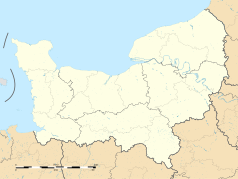 | |||
 48°59′N 0°51′W/48,983333 -0,850000 48°59′N 0°51′W/48,983333 -0,850000 | |||
| |||


Saint-Denis-Maisoncelles – miejscowość i dawna gmina we Francji, w regionie Normandia, w departamencie Calvados. W dniu 1 stycznia 2016 roku z połączenia 20 ówczesnych gmin – Beaulieu, Le Bény-Bocage, Bures-les-Monts, Campeaux, Carville, Étouvy, La Ferrière-Harang, La Graverie, Malloué, Montamy, Mont-Bertrand, Montchauvet, Le Reculey, Saint-Denis-Maisoncelles, Sainte-Marie-Laumont, Saint-Martin-des-Besaces, Saint-Martin-Don, Saint-Ouen-des-Besaces, Saint-Pierre-Tarentaine oraz Le Tourneur – powstała nowa gmina Souleuvre en Bocage[1]. W 2013 roku populacja Saint-Denis-Maisoncelles wynosiła 98 mieszkańców[2].
Przypisy
- p
- d
- e
Gminy okręgu Vire


