Dallas-Fort-Worth-Metroplex
| Dieser Artikel wurde aufgrund von inhaltlichen Mängeln auf der Qualitätssicherungsseite des Projektes USA eingetragen. Hilf mit, die Qualität dieses Artikels auf ein akzeptables Niveau zu bringen, und beteilige dich an der Diskussion! Folgende Mängel sollten behoben werden, bevor diese Markierung entfernt werden kann: Ausbau samt Quellen --Crazy1880 20:40, 23. Jul. 2012 (CEST) |  |


Der Dallas-Fort-Worth-Metroplex ist eine Metropolregion in den Vereinigten Staaten um die Städte Dallas, Arlington (Texas) und Fort Worth. Er zählt als 61.-größter Verdichtungsraum weltweit und viertgrößter der USA; größter Verdichtungsraum von Texas und derzeit (2020) gemäß US Census die Metropolregion mit der höchsten Bevölkerungswachstums-Quote der USA.[1]
Die Metropolregion wird vom Office of Management and Budget zu statistischen Zwecken als Dallas–Fort Worth–Arlington, TX Metropolitan Statistical Area geführt.[2] Zum Zeitpunkt der Volkszählung von 2020 hatte das Gebiet 7.637.387 Einwohner.[3]
Die Region lässt sich unterteilen in Dallas–Plano–Irving und Fort Worth–Arlington.[4]
Countys
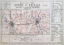
Über die Stadträume der Millionenstädte hinaus erstreckt sich der Metroplex über 12 Countys, wobei auch noch die Städte Carrollton, Denton, McKinney und Richardson dazugezählt werden.
- Collin County
- Dallas County
- Delta County
- Denton County
- Ellis County
- Hood County
- Hunt County
- Johnson County
- Kaufman County
- Parker County
- Rockwall County
- Somervell County
- Tarrant County
- Wise County
Siehe auch
Einzelnachweise
- ↑ US Census Bureau: Metropolitan and Micropolitan Statistical Areas Totals: 2010-2019. In: census.gov. Abgerufen am 23. März 2024.
- ↑ OMB BULLETIN NO. 20-01. Abgerufen am 25. April 2022.
- ↑ 2020 Population and Housing State Data. Abgerufen am 26. April 2022.
- ↑ US Census Bureau: Metropolitan and Micropolitan Statistical Areas Totals: 2010-2019. In: census.gov. Abgerufen am 23. März 2024.


