Çamaş
District and municipality in Ordu, Turkey
40°54′09″N 37°31′41″E / 40.90250°N 37.52806°E / 40.90250; 37.52806 (2022)[1]
52430
Çamaş is a municipality and district of Ordu Province, Turkey a historical Laz settlement.[2] Its area is 81 km2,[3] and its population is 8,211 (2022).[1] The town lies at an elevation of 590 m (1,936 ft).
Composition
There are 23 neighbourhoods in Çamaş District:[4]
- Akköy
- Akpınar
- Budak
- Burhangüneyi
- Çavuşbaşı
- Danışman
- Edirli
- Giden
- Gümüşlü
- Hisarbey
- Kemalpaşa
- Kestaneyokuşu
- Kocaman
- Örmeli
- Sakargeriş
- Sarıyakup
- Söken
- Sucuali
- Taşoluk
- Tepeli
- Uzunali
- Yenimahalle
- Yeşilvadi
References
- ^ a b "Address-based population registration system (ADNKS) results dated 31 December 2022, Favorite Reports" (XLS). TÜİK. Retrieved 19 September 2023.
- ^ Büyükşehir İlçe Belediyesi, Turkey Civil Administration Departments Inventory. Retrieved 19 September 2023.
- ^ "İl ve İlçe Yüz ölçümleri". General Directorate of Mapping. Retrieved 19 September 2023.
- ^ Mahalle, Turkey Civil Administration Departments Inventory. Retrieved 19 September 2023.
External links
![]() Media related to Çamaş at Wikimedia Commons
Media related to Çamaş at Wikimedia Commons
- District governor's official website (in Turkish)
- Road map of Çamaş and environs
- v
- t
- e
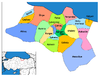
Çamaş in Ordu Province of Turkey

| Istanbul | |
|---|---|
| West Marmara | |
| Aegean | |
| East Marmara | |
| West Anatolia | |
| Mediterranean | |
| Central Anatolia | |
| West Black Sea | |
| East Black Sea | |
| Northeast Anatolia | |
| Central East Anatolia | |
| Southeast Anatolia | |
Metropolitan municipalities are bolded.
 | This article about a Black Sea Region of Turkey location is a stub. You can help Wikipedia by expanding it. |
- v
- t
- e


