Jennelt
Village of Krummhörn in Lower Saxony, Germany

Coat of arms
Location of Jennelt

53°27′49″N 7°07′50″E / 53.46371°N 7.13052°E / 53.46371; 7.13052
26736
Jennelt is a village in the region of East Frisia, in Lower Saxony, Germany. It is part of the municipality of Krummhörn. The village is located to the east of Visquard and to the south of Eilsum.
Jennelt was built on a warft and already mentioned as Gein Leth in the 8th/9th century. Other early spellings include Geenlede, Jennlede, Jennlete, and Jennlet.[1] In the last half of the 13th century, the Church of Jennelt was built on the western side of the elongated village.[2]
Gallery
-
 Chapel in Jennelt
 -
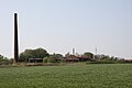 Former brickworks near Jennelt
 -
 Interior of the church


References
External links
 Media related to Jennelt at Wikimedia Commons

 | This German location article is a stub. You can help Wikipedia by expanding it. |
- v
- t
- e


