Yavuzeli
District and municipality in Gaziantep, Turkey
37°19′09″N 37°34′07″E / 37.31917°N 37.56861°E / 37.31917; 37.56861 (2022)[1]
27970
Yavuzeli is a municipality and district of Gaziantep Province, Turkey.[2] Its area is 468 km2,[3] and its population is 22,762 (2022).[1]
Composition
There are 44 neighbourhoods in Yavuzeli District:[4]
- Akbayır
- Aşağıhöçüklü
- Aşağıkayabaşı
- Aşağıkekliktepe
- Bağtepe
- Bakırca
- Ballık
- Beğendik
- Bülbül
- Büyükkarakuyu
- Çiltoprak
- Çimenli
- Cingife
- Cumhuriyet
- Değirmitaş
- Düzce
- Fevzi Çakmak
- Göçmez
- Gülpınar
- Hacımallı
- Havuz
- Hürriyet
- Ilıcak
- Karabey
- Karahan
- Karahüseyinli
- Kasaba
- Keşrobası
- Küçükkarakuyu
- Kuzuyatağı
- Örenli
- Saraymağara
- Sarıbuğday
- Sarılar
- Şenlikçe
- Süleymanobası
- Sultan Selim
- Tokaçlı
- Üçgöl
- Yarımca
- Yeniyurt
- Yöreli
- Yukarıkekliktepe
- Yukarıyeniköy
Notable people
- Ahmet Eyüp Türkaslan, Turkish footballer (1994−2023).
References
- ^ a b "Address-based population registration system (ADNKS) results dated 31 December 2022, Favorite Reports" (XLS). TÜİK. Retrieved 12 July 2023.
- ^ Büyükşehir İlçe Belediyesi, Turkey Civil Administration Departments Inventory. Retrieved 12 July 2023.
- ^ "İl ve İlçe Yüz ölçümleri". General Directorate of Mapping. Retrieved 12 July 2023.
- ^ Mahalle, Turkey Civil Administration Departments Inventory. Retrieved 12 July 2023.
- v
- t
- e
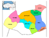
Yavuzeli in Gaziantep Province of Turkey

| Istanbul | |
|---|---|
| West Marmara | |
| Aegean | |
| East Marmara | |
| West Anatolia | |
| Mediterranean | |
| Central Anatolia | |
| West Black Sea | |
| East Black Sea | |
| Northeast Anatolia | |
| Central East Anatolia | |
| Southeast Anatolia | |
Metropolitan municipalities are bolded.
 | This article about a Southeastern Anatolia Region of Turkey location is a stub. You can help Wikipedia by expanding it. |
- v
- t
- e


